
Land off Whittington Road,
NEW WHITTINGTON, Chesterfield
KEY CONSIDERATIONS
Access Strategy
An emerging transport strategy is being prepared to accompany the scheme. This includes:
-
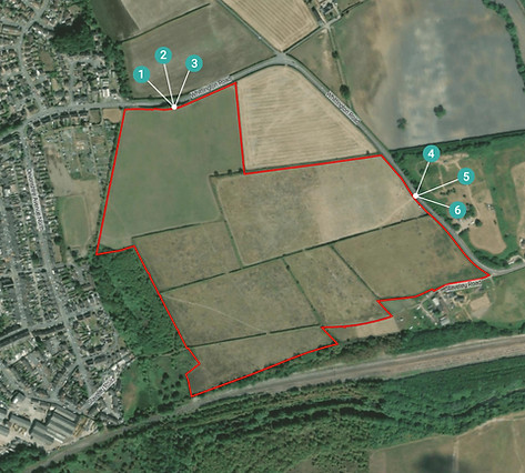
Two new vehicular access points from Whittington Road, together with pedestrian and cycle links and associated infrastructure.
-
The internal street network is being considered to accommodate bus penetration through the site, where practicable.
-
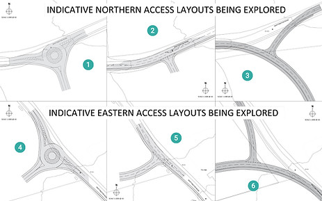
Multiple access options are under consideration, including roundabouts, ghost island right-turn junctions, and a potential reconfiguration of Whittington Road to directly lead into the site.
-
Pedestrian and cycle connectivity is expected to form an important part of the emerging masterplan, including links towards Albert Road, the existing public rights of way network, and local destinations in New Whittington. Consideration is also being given to enhance routes external to the site toward primary destinations within the surrounding street network, to help provide safer and quieter routes for pedestrians and cyclists.
click to magnify
A Transport Assessment will accompany the application, and will examine how the existing sustainable transport infrastructure in and around New Whittington can be further enhanced to improve the existing connections. The Assessment will also ensure that the proposed development will not cause unacceptable impacts on the road network, whilst ensuring that the development is well connected to the surrounding area for all modes of transport.
Some potential indicative options for vehicular access to the site have been proposed for this public consultation. These access options are subject to ongoing technical work and discussion with the Local Highways Authorities.
click to magnify
Drainage & Flood Risk
The site falls within Flood Zone 1, with areas of flood risk associated with the River Rother located to the South of the Railway line, South of the site. The proposals have been carefully designed around the areas of surface water flood risk associated with the local area. An existing low-to-medium probability flow route for surface water passes through the site. It is proposed that this will be resolved by the new surface water drainage system being put into place on site. All structures are proposed to be located outside of the areas of highest flood risk.
A full assessment of the flood risk affecting the site will be undertaken, to ensure that the proposals will not impact or exacerbate offsite flood risk.
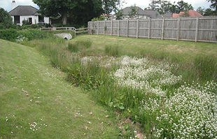
Surface water will be managed through Sustainable Drainage Systems (SuDS) principles – ensuring that water is attenuated and drained from the site without affecting the wider area. Attenuation basins will provide drainage benefits to the site, whilst encouraging ecological improvements.

click to magnify

click to magnify




Ecology
The Applicant and their ecological consultants are working with the Local Nature Recovery Strategy to create higher value grasslands and structured habitats which provide ecological enhancement alongside public access to nature.
The proposed development has been informed by a comprehensive suite of ecological surveys. The landscape strategy for the site will be carefully designed, seeking to improve the existing biodiversity on site, with a mix of open space types incorporated into the masterplan.
The masterplan shows areas of green space to be provided as part of the proposed development. This is proposed to include play areas, natural open spaces, and improved public footpath access. The proposed development will seek to incorporate native tree, shrub, and grassland planting where possible to provide high quality and biodiverse public open green space.
